Connectivity - The Importance of Joining up Habitat
A huge amount of work is going on behind the scenes to ensure Norfolk and Suffolk's wildlife is given the space it needs to thrive, and move around the region.
The next 18 months will see a new Local Nature Recovery Strategy created for both counties, which will cover everything from new habitat creation, to enhancement and connectivity.
Dave Smart is from The Norfolk and Suffolk Nature Recovery Partnership and in his first piece for WildEast explains why habitat connectivity is so vital for biodiversity recovery.

'We now know that the UK is one of the most nature-depleted countries in the world, with about half of its biodiversity left and it has been suggested that the country may not have enough biodiversity to prevent a meaningful recovery. Such an ecological recession could lead to a future in which ecosystems do not have enough biodiversity to function well, leading to crop failures that could cause shortages in food, energy and materials.'
It’s no wonder that Professor Sir John Lawton, in his 2010 ‘Making Space for Nature’ report for Government said that “There is compelling evidence that England’s collection of wildlife sites are generally too small and too isolated, leading to declines in many of England’s characteristic species”. His subsequent recommendations about what needs to be done were many but are summarised in what has been an often-used phrase, ‘More, Bigger, Better and Joined up’. That was 12 years ago but the recommendations remain unchanged and retain even more importance today in the face of climate change and other pressures on the environment.
In England many of our protected sites, those most special places for plants and animals, exist within a landscape heavily modified over time by human activity and subsequent industrial and agricultural revolutions. As a result of this habitat fragmentation, they can be viewed as islands of species richness, as reservoirs of surviving biodiversity. In isolation, and without the ability to join-up with other such sites they support increasingly threatened and isolated populations of wildlife, putting their longer-term viability at risk.
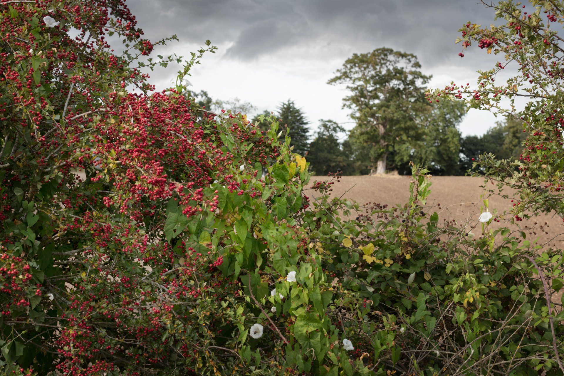
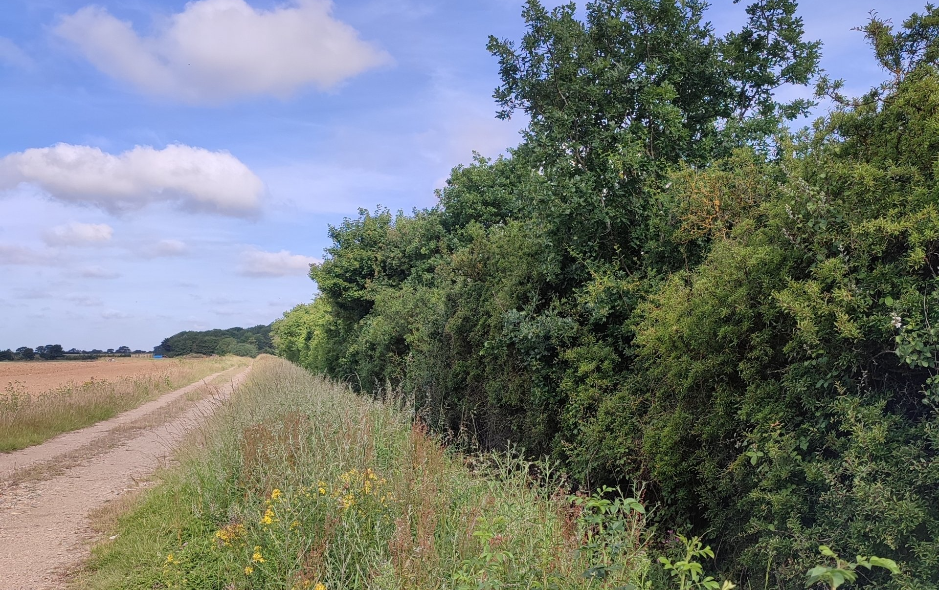
Habitat connectivity is of the utmost importance in joining-up separate sites or patches of habitat. These habitat patches can vary in size and may be connected by narrow zones of habitat, called wildlife corridors, which allow animals to move from patch to patch. This kind of connectivity enables animals to move in search of food, mates, living space, and more. Examples of functioning habitat connectivity within our existing landscape are hedgerows.
Largely created as a result of the Enclosure Acts, dating from the 1600’s where the previous open field system of farming was abolished to make way for new forms of land ownership, to lead the way for fences and hedges, enclosing different land parcels. Where hedgerows have survived the 20th Century agricultural revolution (which subsidised their removal) they join up woodlands, copses and other habitats and provide important habitats for a wide range of species.

A mixture of tree, shrub species and structure can support diverse populations of birds, mammals and invertebrates. An old oak pollard can provide nesting sites for tawny owl, great tit, bats and native bees. Nuthatch and treecreepers forage among the cracks and crevices in the bark and a myriad of invertebrates feed on the leaves. Bramble in hedgerow gaps provides a source of nectar for a wide range of butterflies and other insects and where a hedgerow is allowed to tumble into the adjoining field margin it can provide ideal conditions for nesting yellowhammer.
Transport corridors
Surprisingly our road and rail networks can provide excellent habitat corridors for particular species. While they can often be subject to quite severe management and cutting back, this does arrest the natural succession process and can provide valuable scrubby habitats in areas where human disturbance is often at a minimum. Previously unknown doormouse populations have been discovered on sections of the A12. Some road verges support important plant communities on patches of surviving species rich grassland including several national rarities such as crested cow wheat, man orchid and sulphur clover.
Riparian
Riparian habitats or habitats associated with rivers and other such watercourses provide for excellent connectivity opportunities. Where a watercourse is buffered by margins of permanent grassland or tree planting, water quality can be enhanced by intercepting diffuse agricultural pollution, benefitting aquatic plants, fish and other organisms. In the right place restored floodplain grassland, if managed correctly and with the ability to retain some winter flood water into the spring, can be an attractive place for lapwing to nest. In addition, some of these habitat restoration methods can also offer a reduction in seasonal flooding in our towns and villages. These natural flood management techniques are also known as a ‘nature-based solutions’ and are becoming more commonly adopted.

Not just the ambition, but the ability to act now is vital in response to the climate and biodiversity crises. The Norfolk and Suffolk Nature Recovery Partnership, working collaboratively with stakeholders across both counties have
- agreed to pursue innovative approaches in highway corridor management, aiming to develop ways of using them to connect our important sites for nature, cutting across political and administrative boundaries.
- agreed to develop more carbon sequestration projects including ambitious tree planting programmes in both counties to create not just more woodlands but hedgerows and trees in the urban environment, connecting our gardens with the wider countryside.
- committed to help restore our rivers, working with catchment-based projects. Current exemplars include the Brecks, Fen Edge and Rivers Project and the Wendling Beck Environmental Project.
The next 18 months or so will see both counties deliver a Local Nature Recovery Strategy. It will include a map of our existing nature rich places and then, after a broad community wide engagement, capturing views and ideas, a map of where to prioritise new habitat creation, enhancement and connectivity to reverse the decline of biodiversity and to identify and prioritise opportunities for Nature Recovery. If you’re interested in finding out more or how to get involved, or even better if you have any ideas on how to develop habitat connectivity in Norfolk or Suffolk please contact Dave Smart on: david.smart@suffolk.gov.uk
WildEast Blog